

Drainage and plumbing, Oakridge
Drainage and Plumbing in Oakridge, Vancouver
Oakridge runs from W 41st Avenue down to W 57th, Granville Street across to Ontario and Main. 401 hectares, and the only neighbourhood in Vancouver with its own named groundwater notice from the City.
The water table under here has been held down by pumping since 1958. We camera the line before anybody quotes a number, and the footage is yours.
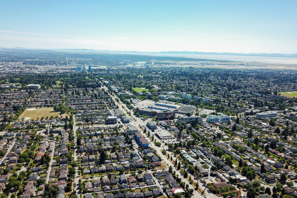
One block, two eras of pipe
Oakridge started in 1950, when the CPR opened the undeveloped forested land, and the bungalows went up through the 1950s and 1960s on what one history calls new treeless streets. Every boulevard tree here was planted after the houses, which is worth remembering when someone tells you the trees came first.
On the Cambie side of the neighbourhood, 49.3% of the standing houses were built between 1940 and 1969, and the 1960s is the single biggest decade at 22.3%. The 1970s is almost a hole at 2.5%. Then 22.9% was built or rebuilt from 2000 onward. So a single Oakridge block can genuinely be 1958 clay on one lot and new PVC on the next.
Under the road the split is just as sharp. Of 1,059 City sewer main segments inside Oakridge, 503 are still combined, 47.5%, one pipe carrying rain and sewage together. 433 of them, 40.9%, are vitrified clay. In the Laurel Street corridor 21 of 35 segments are still combined. Oakridge is not the worst in the city for this. Sunset and Kerrisdale are both higher. It is squarely mid pack, and mid pack still means about half.
The ground falls south and east. It sits around 95 to 100 metres at 41st and Oak and drops to roughly 40 to 55 metres at 57th and Cambie, depending which elevation model you trust. Water leaves Oakridge toward Marpole and the Fraser. And what is underneath is glacial upland, Vashon Drift till with sand and gravel lenses, not Fraser delta silt. The delta starts around the Oak Street Bridge, thirteen blocks south of here.

Oakridge has its own groundwater notice, and it changes the job
The City’s Groundwater Management Bulletin carries an appendix called Notification Regarding Water Levels in the Oakridge Area. It is the only place in that bulletin where a Vancouver neighbourhood gets a notice of its own. Its words: groundwater has been extracted from the site of Oakridge Mall at 41st and Cambie since 1958, and over that time groundwater levels are estimated to have been lowered by up to 6 metres at Oakridge, with less effect the further you get from the site. The bulletin says that artificially lowered level is to be roughly maintained, and that it may change over time.
Read that again with a crawlspace in mind. A dry basement on those blocks is partly borrowed rather than natural, and the lender has said the terms may change.
The same bulletin sets the rule that follows. Permanent post construction dewatering of water from saturated soils is not permitted to be discharged to the City’s sewer system, and it names permanent on site drainage infrastructure such as perimeter and foundation drains specifically. Its reason is capacity: the sewer system within the Cambie Corridor is approaching capacity, so the City is limiting groundwater discharges into it. A UBC report on Vancouver groundwater says the same thing independently, that the Cambie sewershed is included as an area of concern because the main is nearing capacity.
Anyone quoting an Oakridge drainage job without knowing that is guessing at where the water is allowed to go.
24/7 emergency dispatch
Drainage problem in Oakridge?
Ryan picks up. Live dispatch, and you get a real arrival window on the call. We camera the line before anybody quotes a number, and you watch the monitor with us.
What Vancouver customers say
Ryan was great! My landlord called him to fix my blocked kitchen sink. He showed up the same day (on a Sunday) and fixed the problem. He even cleaned the sink and dried up all the water that had leaked before he got there. And he was very careful coming in and out of the house so my cat wouldn’t get out. I’d definitely recommend him.
Ryan is INCREDIBLE. He has been responding to all of us (four houses and families!) affected by a sewage back up. This is all on Boxing Day and beyond, in terrible weather full of ice, cold and rain. He is so knowledgeable, and knew what was needed right away. Just the top of his field I am sure. As well as that, he is incredibly calm, respectful, kind and fair. I am truly amazed by this person's capacity and competence in combination with his noble, calm presence in the face of a real mess. Thank you Ryan, so very much!
I had very positive experience with Mamba Services, Ryan was amazing to work with and took care of my drain issues in no time. He arrived on time, was very professional and efficient in carrying out the work. What impressed me was how honest he was in recommending needed repair. He was very patient in explaining the different options. I will certainly call them for future projects.
Had an excellent experience. Ryan was fantastic, it was an after hours call late in the evening and he showed up exactly in the time frame he gave. Took care of the kitchen sink issue within minutes all systems were running like new. Pricing was extremely reasonable, Ryan was patient and explained everything to me while fixing my problem. I would highly recommend this company for any plumbing work.
Ryan was efficient, experienced, and knowledgeable. He was able to squeeze me into his schedule with short notice and wasted no time with my appointment. He arrived on site inspected the issue, and was quickly at work with resolving the problem. I am very pleased with his service and honesty. He provided recommendations that will help assist me in future occurrences.
Oakridge drainage and plumbing FAQ
It is an appendix in the City’s Groundwater Management Bulletin, and Oakridge is the only Vancouver neighbourhood that gets one. It records that groundwater has been extracted from the Oakridge Mall site at 41st and Cambie since 1958, that levels are estimated to have been lowered by up to 6 metres, and that the lowered level is to be roughly maintained but may change over time.
Not permanently. The City’s bulletin says permanent dewatering or drainage of water from saturated soils is not permitted to be discharged to the City’s sewer system, and it names permanent on site drainage infrastructure such as perimeter and foundation drains. The reason it gives is that the sewer within the Cambie Corridor is approaching capacity.
Close to a coin flip. 503 of the 1,059 City main segments inside Oakridge are combined, 47.5%, and 40.9% of the whole set is vitrified clay. In the Laurel Street corridor it runs higher, 21 of 35 segments. We can tell you what is under your block before we come out.
On some streets. W 49th Avenue between Oak and Cambie was separated between 2022 and 2024. The current work covers 49th Avenue east of Cambie and Alberta Street between W 49th and W 44th, replacing the old system with one pipe for rainwater runoff and another for sewage, on a main the City rates for a 100 year life. No schedule has been published for the other streets and we will not invent one.
Your side follows. You are responsible for the sewer lines on your property up to where they meet the City’s connection, and By-law 8093 section 2.6 says that in a separate system area no stormwater may be conveyed into a sanitary sewer and no wastewater into a storm sewer. The City’s guidance is to call a private plumbing contractor to scope it and pull the permits.
We will not guess. City open data covers the mains and explicitly excludes residential connections to them, so nobody publishes what runs under your lot. What we can say is that on the Cambie side of Oakridge 49.3% of the standing houses went up between 1940 and 1969, and that four in ten City mains here are still clay. The camera settles the rest.
Sometimes, and the honest version is less dramatic than the usual pitch. Oakridge boulevards are mostly ornamental cherry and plum planted after the houses went in. Laurel Street runs to Kwanzan cherry, Heather Street to Pink Perfection cherry and European beech, Osler Street to Japanese flowering crabapple. The heavy rooted trees in the count are 826 western red cedar, 255 Douglas fir and 131 black cottonwood, and cottonwood is the one that finds a cracked lateral.
Because it is downhill. The ground sits around 95 to 100 metres at 41st and Oak and falls to roughly 40 to 55 metres at 57th and Cambie. Water leaves Oakridge to the south and east, toward Marpole and the river.
No. Oakridge sits on the glacial upland, Vashon Drift till with sand and gravel lenses. The Fraser delta starts around the Oak Street Bridge, about thirteen blocks south of the neighbourhood’s southern edge. There is also no peat under here and no buried creek that anybody has been able to source.
Marpole, South Cambie, Kerrisdale and Sunset are the neighbours and we work in all of them, plus the rest of Vancouver, Burnaby, New Westminster and the North Shore.
24/7 EMERGENCY DISPATCH
Water where it should not be?
Ryan picks up. Live dispatch, and you get a real arrival window on the call.